I think we should celebrate improvements listed on the map such as:
SDOT installed 129 miles of new bike lanes & shallows between 2007 and 2011
There are six green bike boxes around Seattle
SDOT installed 2,230 new bike parking spaces including six on-street racks (perhaps more than that? Metro made them take out the one at Seattle Town Hall where it's quite difficult to park a bike, but I digress.)
Be sure to get a copy.
Taking short trips in Seattle is easy and getting easier all the time.
My frustration comes to the surface when planning a longer bike ride. When you study the map with the intent of planning a route you start to notice important gaps in the network. Of course, there is THE missing link: the gap in the Burke Gilman trail (from the Ballard Locks to where the Shilshole part of the trail picks up) which has been in litigation for over ten years. But that is only one of many missing links. When you get your copy of the map, try this: before opening it, chose a destination of 20 miles or more (other than on one of our excellent bike tails). My choice for Day 9's ride was from Capitol Hill to Alki.
This is a common ride of over 20 miles round trip from where I live. So in the spirit of working around the gaps in the bike route network, I decided that this is a route worth investing in. By that I mean trying all options until you find the best one. This time we hit the route jackpot!!! (Search for the word "jackpot" if you don't want to wait for the route info.) I also wrote the SDOT to see if they had ideas, but I have not heard back yet.
I think it's important to note that the bike map is the official negotiated listing of bike routes. It does not always show the best way from point A to Point B probably because they have to deal with other city departments such as Metro and their concerns; cyclists are not their only priority. Also, I am learning not to be afraid of trying connecting roads that are not labelled. It doesn't mean that they are necessarily bad; it does mean that they are not officially designated for bike use.
The tricky part of the route comes after you ride through the international district and follow the signs to the SODO bike path which parallels the light rail route frоm South Royal Brougham Wаy tо South Forest Street (about 3 miles--it's the dark green line heading south on the map below). Having taken this trail before I knew that it just dead ends at a strange spot, so we knew to get off at S. Lander Street. (Perhaps there is a purpose for that last block, but I fail to understand it.) Now what? Consulting the bike map it indicated that Lander has sharrows. We went that way but I don't recommend it--it just didn't feel safe. So is there a safer way to connect with the West Seattle Bridge trail?
I also consulted Google Maps bicycle maps and here is what it suggested: has anyone tried that strange loop on Royal Brougham?
Eventually we made our way across the West Seattle bridge--there are great bike path improvements here if you haven't ridden it lately and they are well signed.
I love the views of Seattle even on an overcast day.
 |
| West Seattle Passenger Ferry--A nice shortcut if you want to head right to downtown instead of recrossing the bridge. |
Here is Jonathan basking under a palm tree. There is one row of them along the beach which is a little surprising givien Seattle's climate.
After lunch we headed back across the bridge. The bike path routes you on the North side of the bridge which gives you a good view of the Duwamish River.
 |
Duwamish River looking North. |
We were surprised by the improvements along Spokane Street so we stayed on the sidewalk/path. There is an interesting art installation along this whole area. Here is one of the many stencils that provide information about the cultural and historical aspects of the area. Foot traffic was minimal so riding this way was a pleasure. There is more information about the art installation at this link.
And here is where we hit the route jackpot. We turned left on the Busway road around 6th Ave S. It's between 4th Ave S and 6th AveS as shown here in blue. Headed North, it has a wide shoulder. It's more narrow headed South, but still worth a try. This road is not even shown on the bike map--there is just a weird space.
Here is how to connect back to the SODO trail:
Our other new route innovation was not as successful. I had always wanted to try going up the steep hill at Holgate across I-5 to join up with the branch of the I-90 trail that opened last summer (the Mountains-to-Sound Greenway Trail--this is the segment that parallels the East side of I-5). You have to climb a short staircase, but then I had to walk the hill as it was too steep for getting started. Jonathan rode part of the way!
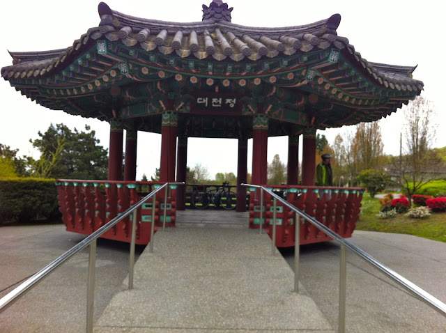
I love passing the pagoda at Daejeon Park.
And here is the inside of the roof.
A lovely day for a ride!


